


Garrison Elementary School Phase II
This institutional and civic project, located in DC’s Shaw and Logan Circle neighborhoods, it's a 6.5-acre multi-functional public park space that serves both the school and the surrounding neighborhood.

Civic Transformation
The site for this project has experienced radical transformation over the several decades.
It was a park in the early 1800's; In the 1860's the site was home to Camp Barker, a contraband camp, which housed over 4000 enslaved peoples, who fled to escape their owners to join the Union Army.
After this era the site was carved into residential parcels through the late 1800's.

The Formation of the Contemporary Block
In the early 1900's 12th Street was razed & the Original Garrison Elementary School was built mid block between 13th & 14th Streets.
It was sometime later that the school was rebuilt to the north along S Street with the play areas in the rear. Since the site and building have fallen into disrepair.

Site Analysis
The renovation of Garrison began with a pro bono effort in 2012 where LAB worked will BELL and Newman architects to reenvison the school's interior layout & its grounds.
The design process started by analyzing the site to determine the best orientation for the classrooms and landscape elements; looking at ways to harness passive & renewable energy.

Community Engagement
The design team worked with the Garrison’s Student Intervention Team (SIT) to solicit program needs for the site.
The principles of site organization were first developed with the SIT as a way into the design process.

Engagement Outcomes
Charrette breakouts with advisors were organized to address the critical needs for the students and the community.
The charrette results were synthesized with the stakeholders before we began the DD phase.
This is the organizing plan that came out of that process.
At the site, the stakeholders wanted a strong sense of community; an emphasis on sustainability; a coupling of play and learning and also wanted the site to address its unique historic past.

Honoring a Historic Site
One of the most notable events that happened at the site is that President Lincoln visited the grounds.
This Image is not a depiction at Garrison; however, in the early 1860's president Lincoln gave a speech to the soldiers and staff at Camp Barker.
The importance of this historic event at the site is part of the history that would be addressed in the design of the landscape.

Building on a Layered Past
One of the major challenges in the design and construction- was addressing the many layers of history embedded in the landscape.
This sheet is one of the many pages from the archeology report of the existing site.
As you can imagine there were major subsurface complications across the playfield. The original foundations of 12th Street, the old elementary school and Camp Barker were all latent infrastructures discovered to still exist embedded in the ground.
The solution which was deployed was to cap the site with 3 layers of geogrid and build the new recreation space above.

Camp Barker
The images here are from the Camp Barker Living History Program. This Civil War program depicts the type of events that took place at the camp during its operation.

History, Education and Community
The results of the geotechnical resolution & community engagement process was a site that preserved the history and invited in the community while also supporting the learning and development of the students.
The Baseball Field, Soccer Field and track are lined with canopy trees and seating to provide shade for the users.
The Big Kids and K-8 playgrounds were also enclosed by Tulip poplars, Elm's and Maples for shade.
Between the two playgrounds, where President Lincoln is said to have given his speech, is where the outdoor classroom is located.
On the front side of the site, adjacent to the main entrance, is a nature walk and small gathering spaces- which are used for classes and before and after school gatherings.

Nature Walk to the Entrance
The nature walk is a native pollinator garden that was designed to provide habitat for pollinators and to primarily have visual interest during times of year that students were in school.
The plants were selected to have somewhat low maintenance due to the capabilities of the school staff.
We also wanted this to be a place that got the students and community excited so a lot of research went into the planting design.
Within the planting palette the plants that set the tone in the nature walk are: Black-eyed Susan’s, Asters, Giant Hyssops, Echinacea, Oakleaf Hydrangea, Red Chokeberry, Virginia Sweetspire, Tulip Poplars and Loblolly Pines which added a playful feature leading up to the entrance.
In the Fall, the planted areas are dominated by brilliant red's & yellow's, green's and textural brown hues.
Our goal was to always have the landscape have visual interest even in the late fall through early Spring.
We really wanted the planting around the site to maximize the intersection of visual interest and peak occupancy.

Nature Walk at Entrance
This is an Fall image looking from the main entrance down the side ramp that is buttressed by the Loblolly Pines.
On the bottom right you can see one of the many artworks that was incorporated into the site.
This bench is accompanied by two other similar works by artist Valarie Theberge.
The design team worked with the city and local artists to advance the art pieces and strategically locate the works around the site.

Stormwater Infrastructure as Learning Garden
In addition to the Nature Walk- three large stormwater managements areas were designed to be performative site elements as well as learning gardens and opportunities for the students to engage with the landscape.
These two images are a bioretention facility located ether side of the Outdoor Classroom.
Stepping stones were placed through the BMP to allow students to walk through this part of the landscape. (we knew that they would do it anyway so we did this to guide them).
The boulders here were strategically located to be used as seating in the Classroom and to serve as play elements.
-I'm sure that some parents weren't too happy after they realized what we did. The kids however, love it!

Nature & Play
This is an image from the soccer field looking North across the Big Kids play area
The Tulip Poplars are located in the center of the main walk though the play areas
They are still in their infancy here but will grow to provide shade for the adjacent play areas

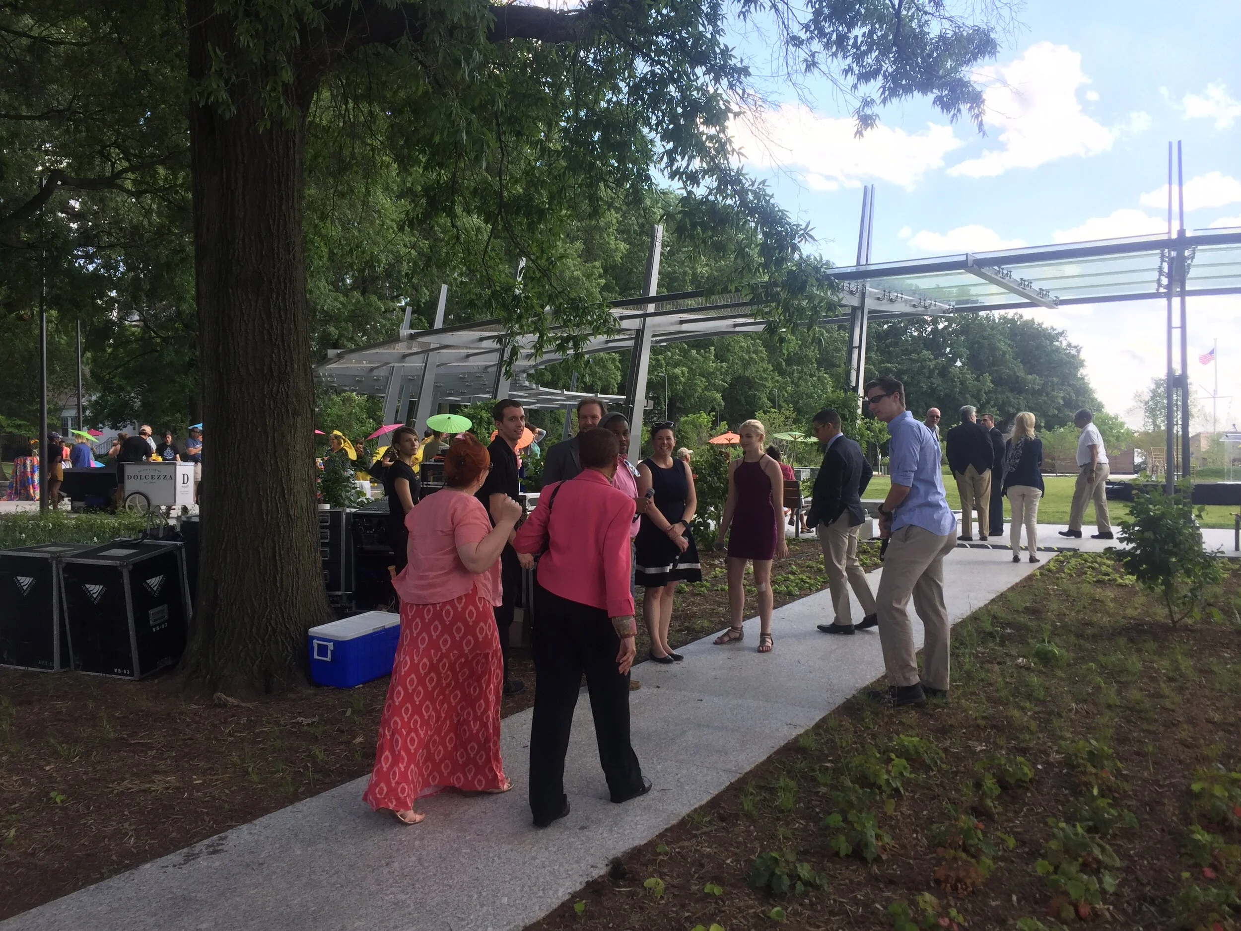
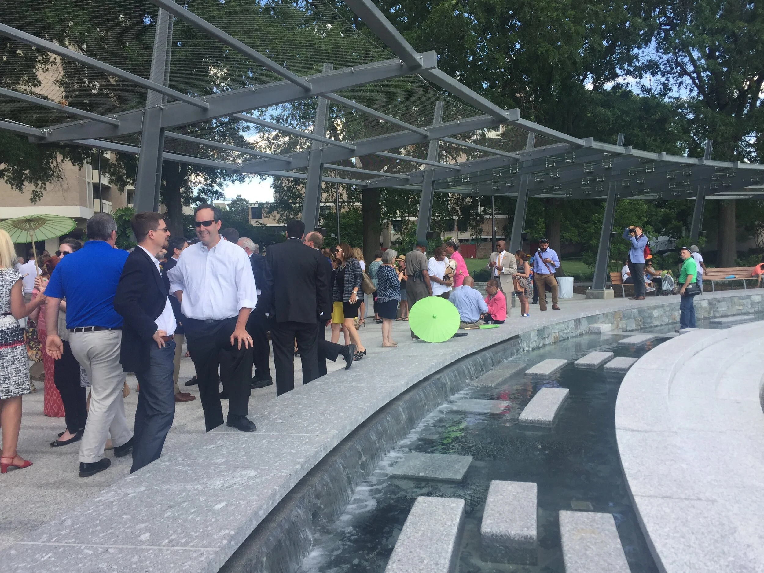
Multiuse Site Designed for Community and Education
This image is also looking North just in front of the south bioretention facility which accepts the runoff from the fields.
On the weekends we see parents out exercising and kids occupying the play areas
It's vastly different from how this space was utilized in the past: There was practically no usage by kids on this side of the grounds and no activity on the weekend.

Nature as a Buffer
One of the goals that came out of the public outreach process was to surround the students with nature.
We used a dense layer vegetation at the perimeter of the building to create a buffer between the indoor learning spaces and the city, beyond.
The idea was that this buffer would help student focus while they were inside the school.

Art & Play
The artwork at the outdoor classroom is designed by Davis McCarty is a playful interpretation of the tents at Camp Baker.
The kids seem to absolutely love it.
As you can see here this outdoor learning space is used equally for recreation and learning (maybe a little more for play but that's OK).


Play & Learning
When the outdoor classroom isn’t in session it’s one of the students favorite play areas. The playful seating elements promote use of the space whenever the site is occupied.


Entry Gateways with History and Art
The three entrances to the play areas on the south of the site were designed by After Architecture- with art Medallions embedded into the gateway panels by artist Vinnie Bagwell.
This art celebrates local African American history.
The artworks all add scale and character to the site; they are playful; they all have great visual effects and uniquely tie into the history of the site.

West Gateway
This is the largest and most used community entrance at the site.

Garrison Elementary School Phase I

SD Aerial at Vermont Ave

Renovation Plans and North Elevation

Planting Plans

Spring Planting Diagram

Fall Planting Diagram

Nature Walk

Ingleside at Rock Creek Park
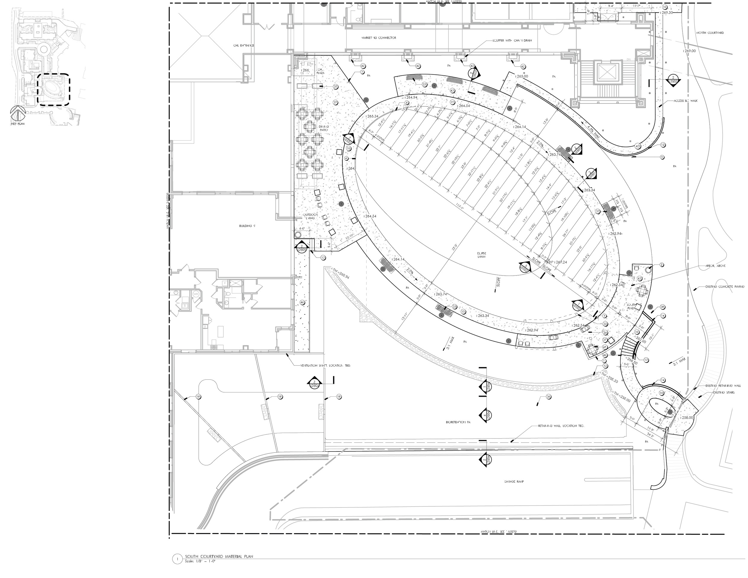
South Courtyard Material Plan

South Courtyard Planting Plan

South Courtyard Seasonal Planting Diagram

Building 8 & Overlook Material Plan

Building 8 & Overlook Planting Plan

Building 8 & Overlook Seasonal Planting Diagram

Building 8 & McCracken Material Plan

Building 8 & McCracken Planting Plan

Building 8 & McCracken Seasonal Planting Diagram

Building 9 & Therapeutic Garden Material Plan

Building 9 & Therapeutic Garden Seasonal Planting Plan

Building 9 & Therapeutic Garden Seasonal Planting Diagram

Military Road Planting Plan

Military Road Seasonal Planting Diagram


Planting Plan

Marvin Gaye Trail

Site

Hub 1 Plan

Hub 1 Section

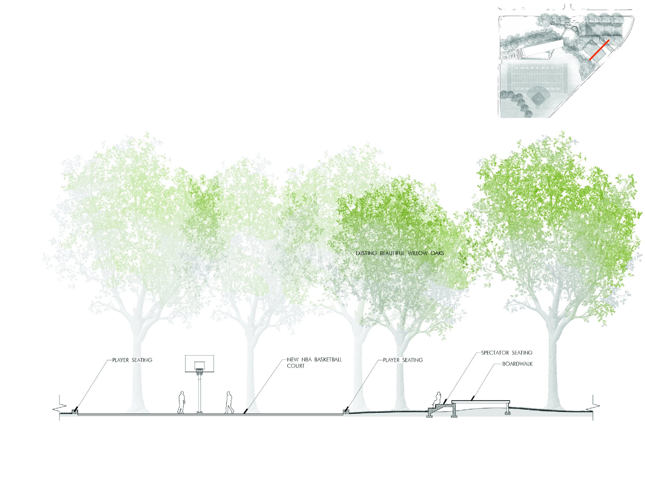
Hub 2 Plan

Hub 2 Section

Hub 3 Plan

Hub 3 Section
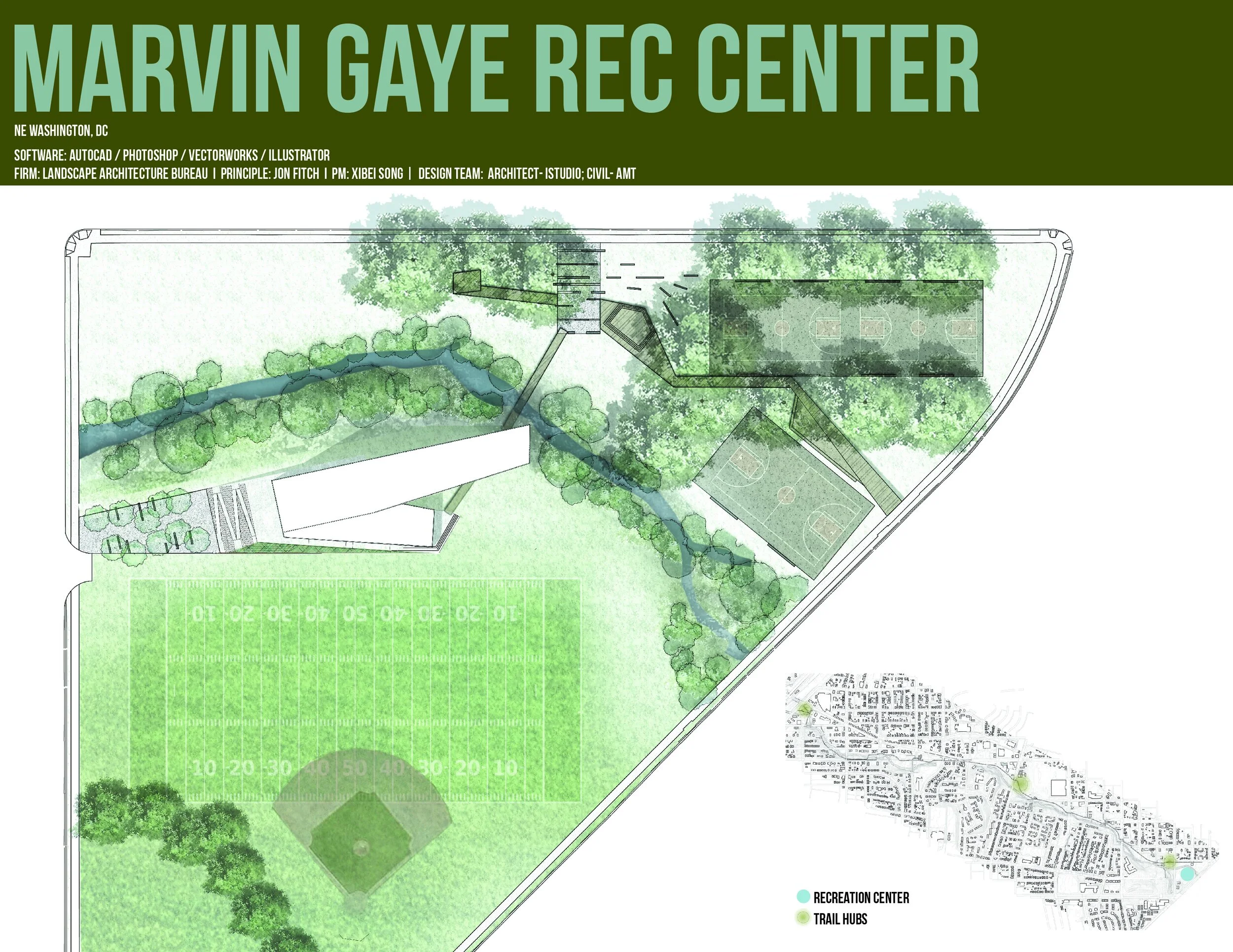
Marvin Gaye Recreation Center

North Plan Enlargement


South Plan Enlargement


Union Station to Georgetown


USGT Streetcar Alignment Options

USGT Station Design Considerations

USGT Station Typologies

Proposed Stop at New Jersey Ave, NW

Proposed Stop along K Street, NW

Proposed Stop at Union Station

USGT Typical Streetscape

USGT Typical Streetscape


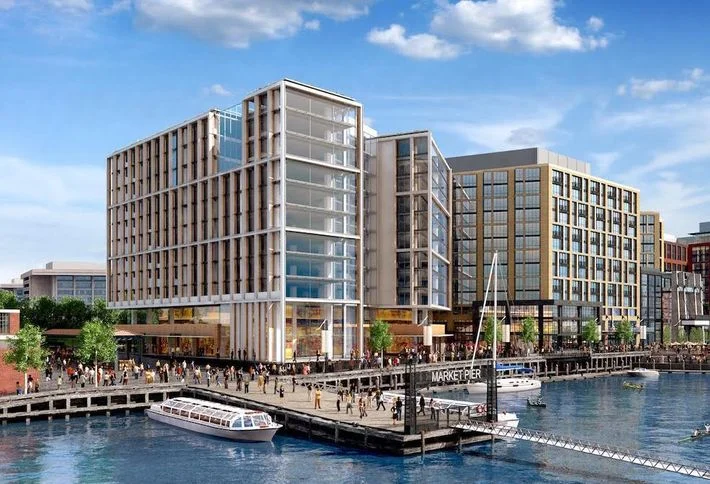
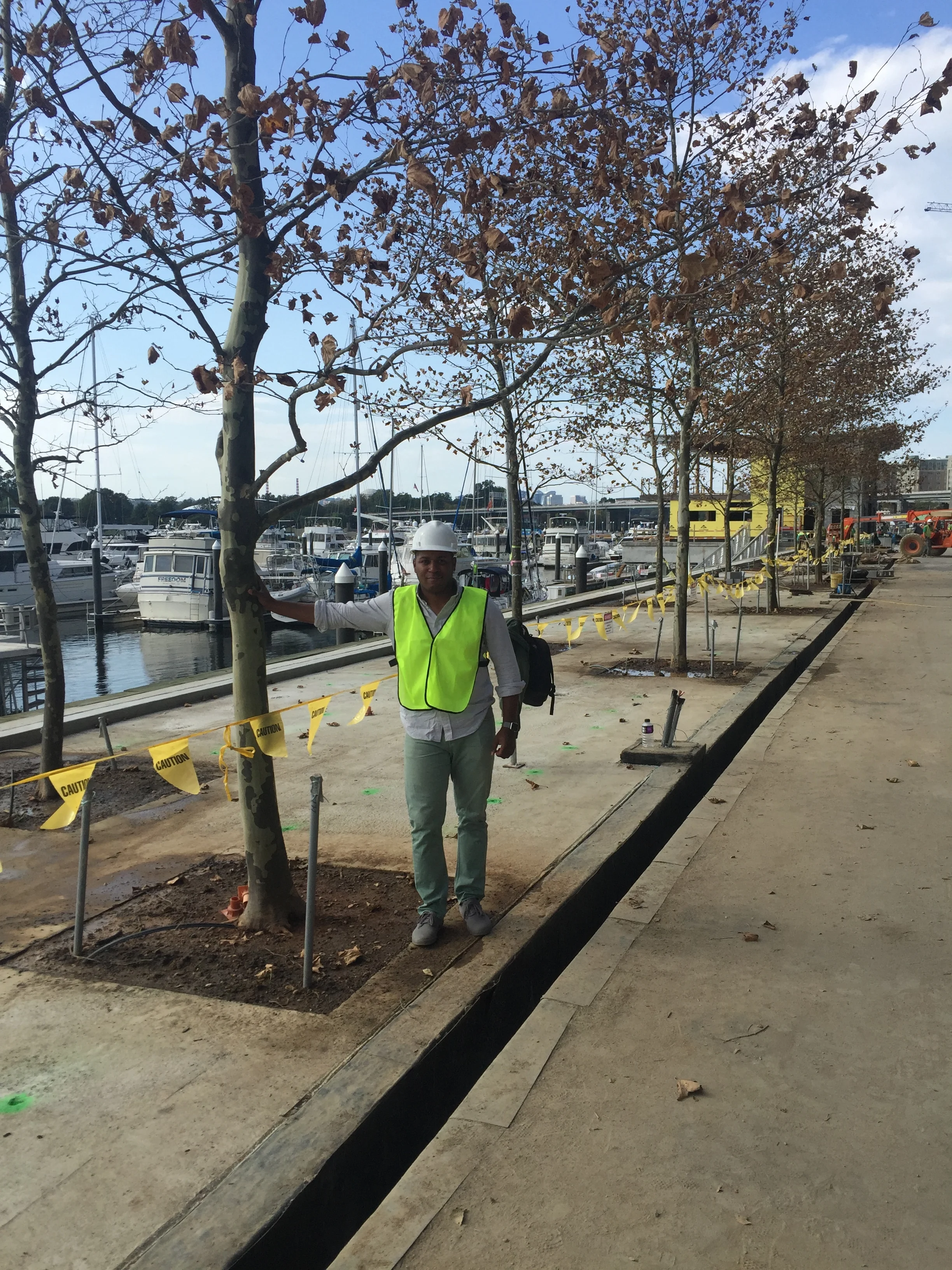
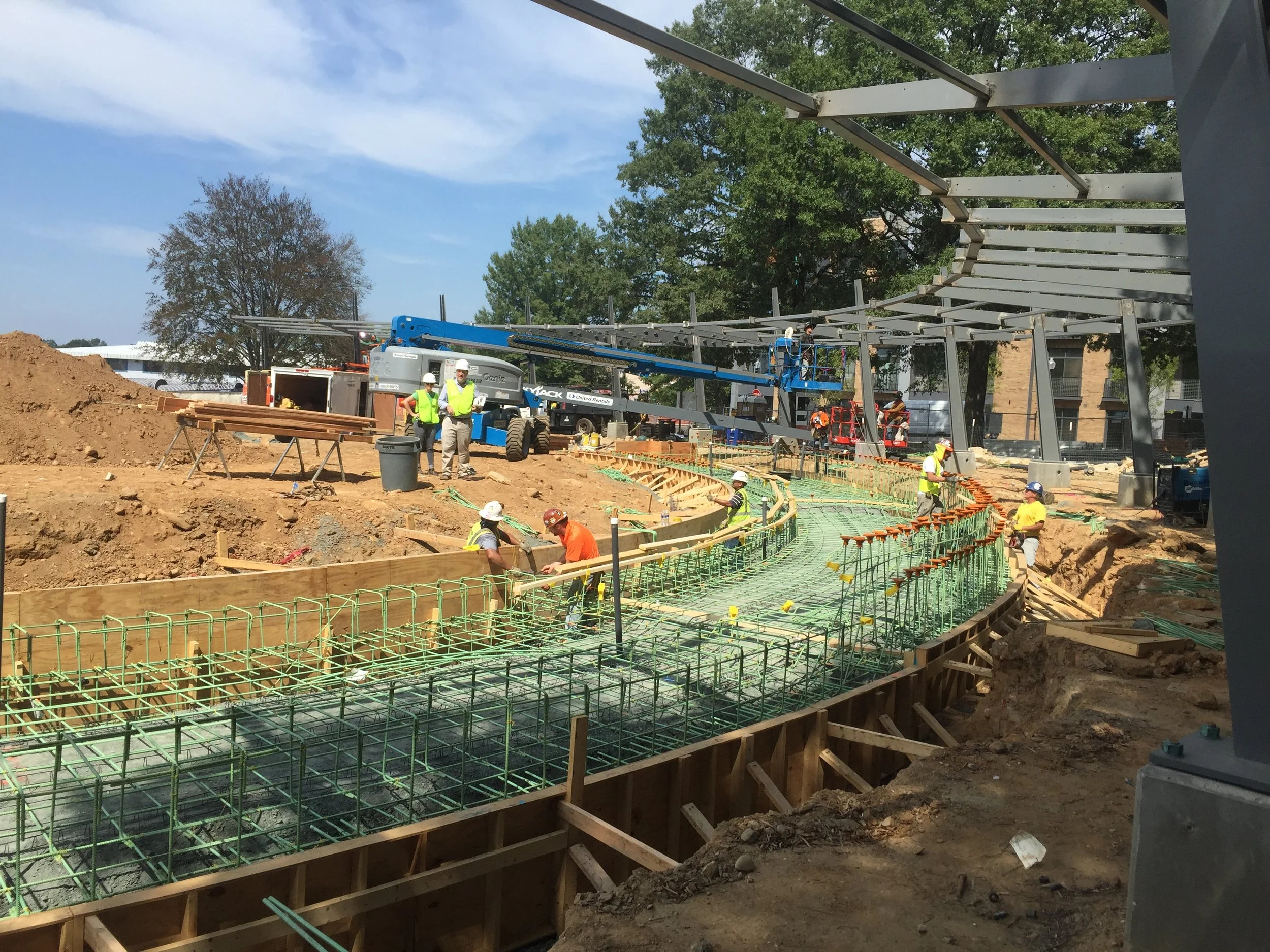
Washington, DC SW Wharf

Historic Wharf

Wharf Aerial Rendering

Promenade Layout

Promenade Sections

Promenade Rendering

Transit Pier & Water Court Plans

Transit Pier Section

Water Court Section

Transit Pier Rendering

CYC Piazza Plan

CYC Piazza Section

CYC Piazza Rendering

Pearl Mews & River Street Plan

Pearl Mews Plan & Section Drawings

Pearl Mews Section Details

Pearl Mews Rendering

River Street Rendering

Promenade Rendering

Promenade Rendering

Promenade Rendering

District Pier Rendering

District Pier Rendering

Promenade Rendering

Transit Pier Rendering
Market Pier Rendering

Promenade Night Rendering

District Pier Rendering

Wharf Aerial over Potomac River

Wharf Plan Rendering


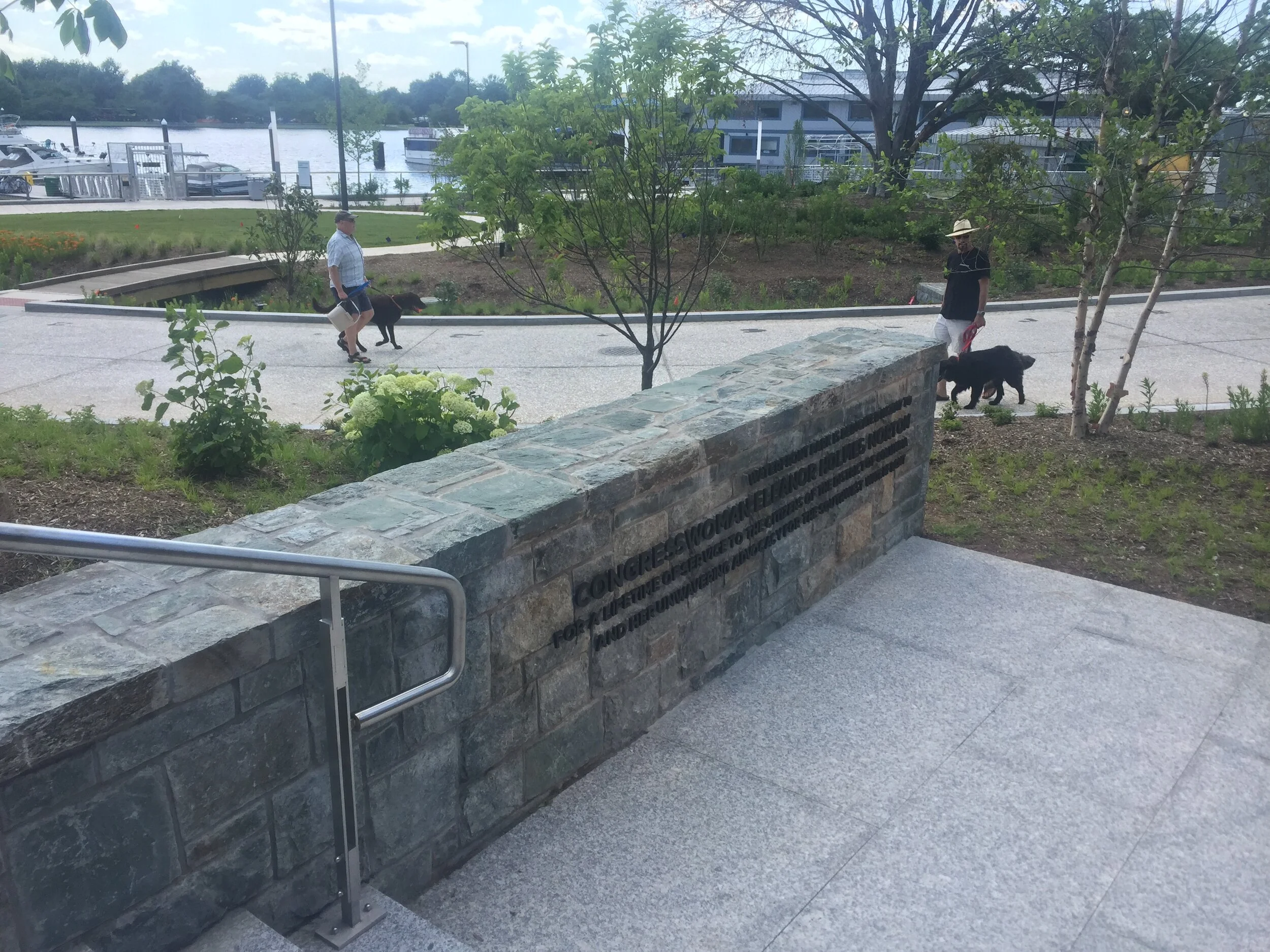
SW Waterfront Park

Waterfront Park Plan

Waterfront Park Plan Detail

Waterfront Park Plan Detail

Pergola Plan, Section & Elevation Details

Pergola Section Deatils

Pergola Plan Details

Pergola Perspective Rendering

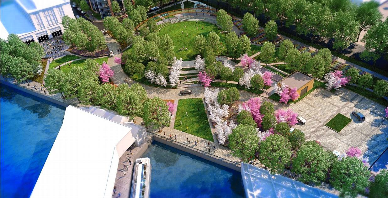
SW Waterfront Park Aerial Rendering

Waterfront Park Knoll Rendering

Waterfront Park Fountain Rendering

Waterfront Park Knoll Night Aerial Rendering


Wharf Hall Terrace


Terrace Material Plan

Terrace Planting Plan

Chimney Cladding Details

Terrace Details

Wharf Hall Rendering

Terrace Aerial

Wharf Hall Rendering


Shepherd Parkway Spur

District Civil War Forts

Shepherd Parkway

Access Road


7900 Wisconsin Avenue

First Floor Plan

Planting Plan

Roof Terrace Plan

Planting Detail

7900 Rendering

7900 Ground Level Rendering

7900 Pyramid Rendering

7900 Pyramid Rendering

7900 Ground Level Night Rendering

7900 Rooftop Night Rendering

7900 Rendering


Historic DuPont Circle


Community Engagement


Corridor Plan

Plan Enlargement 1/7

Plan Enlargement 2/7

Plan Enlargement 3/7

Plan Enlargement 4/7

Plan Enlargement 5/7

Plan Enlargement 6/7

Plan Enlargement 7/7


LeDroit Park Green Infrastructure
Garrison Elementary School Phase II
Garrison Elementary School Phase I
Ingleside at Rock Creek Park
Mediterranean Ambassador's Residence
Marvin Gaye Trail
Marvin Gaye Recreation Center
Union Station to Georgetown Streetcar
Central Utility Plant
Wharf: Horizontal, District Pier, Transit Pier, CYC Piazza, Water Court, Mews, Jazz Alley
SW Waterfront Park
Wharf Hall Terrace
Shepherd Parkway Spur
7900 Wisconsin Avenue
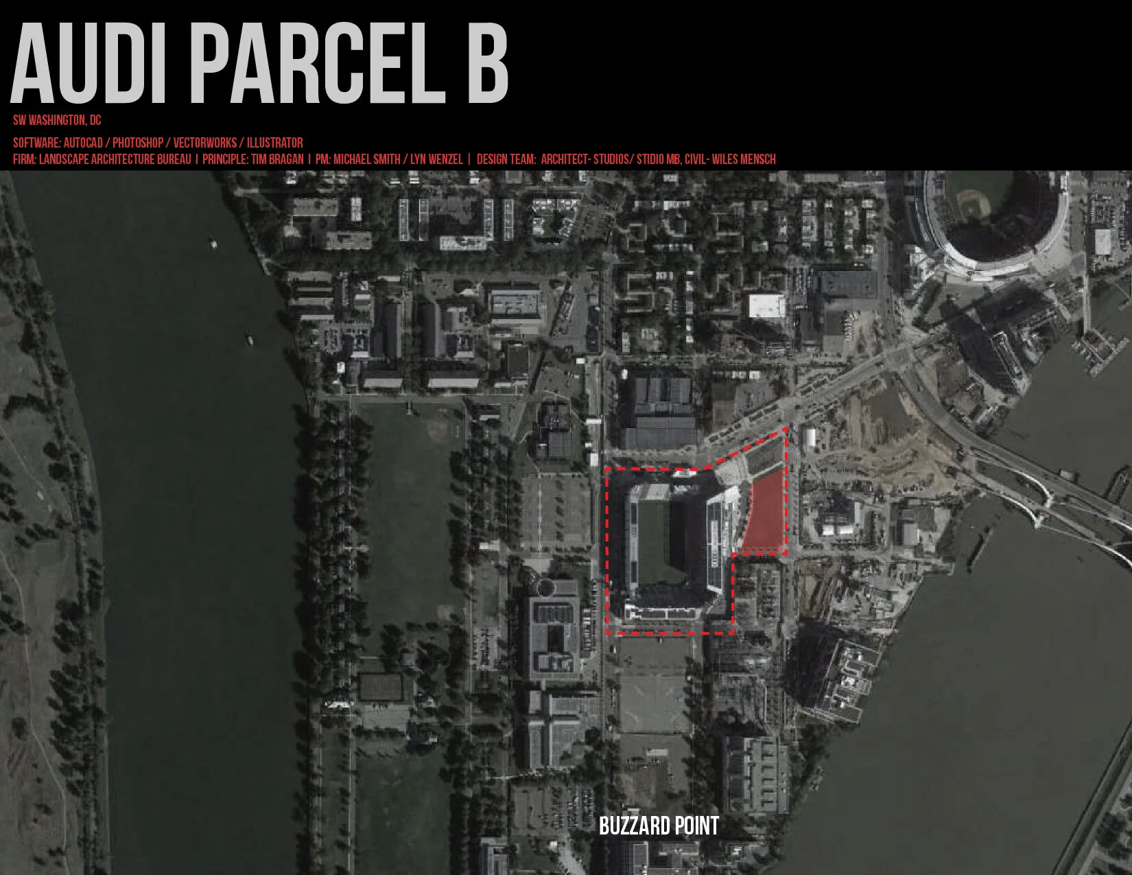
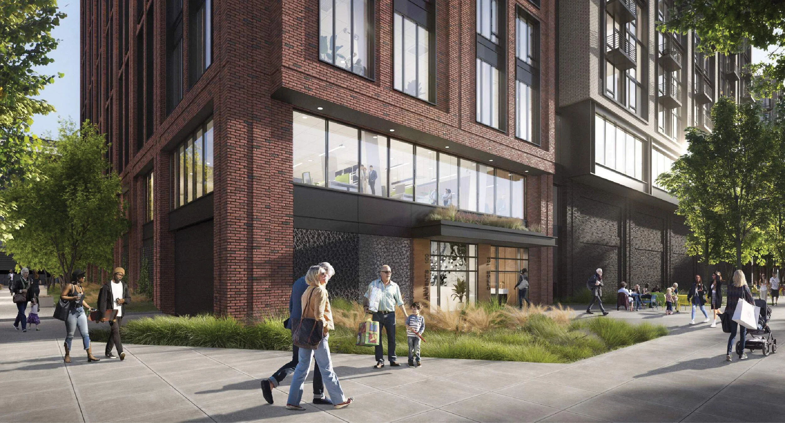
AUDI PARCEL B
INDIANA PLAZA
CONNECTICUT AVENUE STREETSCAPE AND DECKOVER
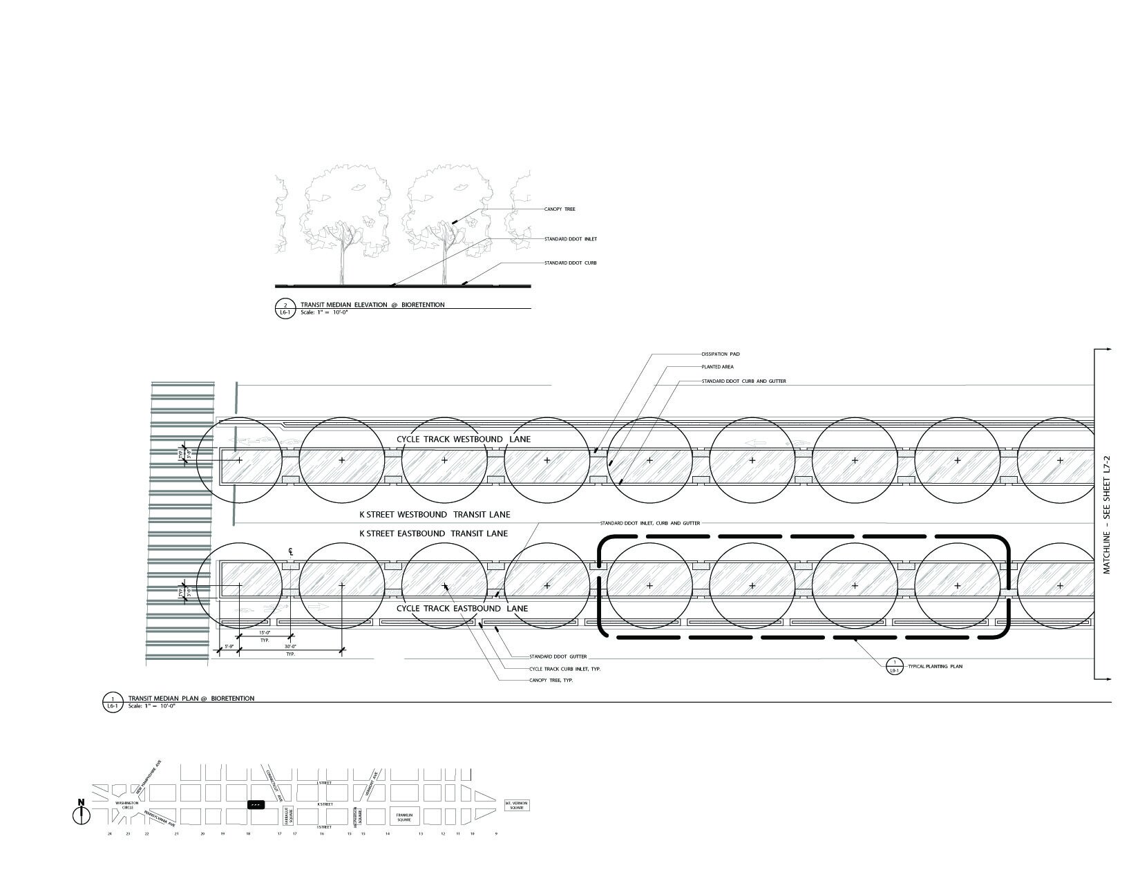
K STREET HISTORIC CORRIDOR AND BUS RAPID TRANSIT